Hey fellow travelers—I've done the “just one more viewpoint” loop on Highway 1 more times than I can count, and I’ve also sat in foggy traffic thinking, “was that stop even worth it?”
In this guide, you’ll get 12 ranked road-trip stops along Northern California’s Highway 1, with drive times, realistic time allocations, and the best viewpoints/trails so you can plan this trip year-round without guessing.
How to plan your Highway 1 northern California road trip

Pick your pace (3-day vs 5-day)
Highway 1 isn’t a “drive fast” route. The best parts are the pull-offs, short walks, and lookouts—so your schedule should include breathing room.
Use this as your baseline:
- 3-day version (packed but doable): ~6–7 hours of driving total (spread across 3 days), with ~1–2 hours per stop.
- 5-day version (my sweet spot): ~8–10 hours of driving total, ~2–3 hours per major stop.
- Any-day “mix and match” plan: Choose 6 stops and aim for morning out + afternoon back to the car (fog clears often, but not always).
When weather changes the plan
Northern CA along Highway 1 has a simple pattern: microclimates.
Expect:
- Fog + wind in summer mornings: Sometimes the coast is clear while 10 minutes inland is sunny (or vice versa).
- Rain and cooler temps in winter: Great for redwoods and fewer crowds, but roads can be slippery.
- Ocean timing matters: Tidepools and “wet” shorelines are usually best around low tide.
Quick reality check:
- If it’s blowing sideways, you’ll still get great views—but shorten beach hikes and stick to bluffs/boardwalk-style routes.
Practical timing from stop to stop
To keep this usable year-round, I’m giving you realistic time blocks, not “drive 40 minutes, arrive, and instantly teleport to the perfect sunset.”
As a rule of thumb:
- Pull-off viewpoint stops: 20–30 minutes (including parking + a short walk)
- Beach/state-park stops: 60–120 minutes
- Headlands/redwoods stops: 90–150 minutes
And add buffer for:
- parking lots filling up (especially weekends)
- slow-moving traffic near trailheads
- “we saw something better, so we stayed” moments (you’re human—like me)
San Francisco to Point Reyes: the dramatic start (Stops 1–3)
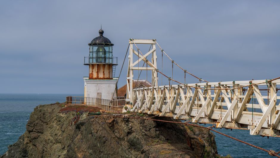
Stop 1: Marin Headlands & Point Bonita (best “wow” starter)
Drive from SF area: ~25–45 minutes depending on where you start.
This is the quick hit that turns the trip on.
How long to spend: 45–90 minutes
Best viewpoints / walks:
- Fort Point / coastal overlooks (quick photo stops): Look for big-cardinal views over the bay and open ocean.
- Point Bonita area: If you walk out toward the lighthouse vicinity, you’ll get classic “coast + rocks + wind” scenery.
Year-round notes:
- Fog rolling in can actually look awesome from the bluffs—just plan for shorter walks.
- Wind is real here. Wear something you won’t hate halfway through the view.
Parking / logistics (general):
- Expect timed entry/park rules to vary by season and traffic, so arrive earlier on weekends.
Stop 2: Stinson Beach (easy access, big payoff)
Drive from Stop 1: ~20–35 minutes.
If you want a beach stop that doesn’t eat your whole day, this is one.
How long to spend: 60–120 minutes
Best viewpoints / trails:
- Beach walk along the sand + bluff edges: Even a slow stroll gives you the coastal feeling.
- Look for short paths that climb to the higher overlooks (when accessible) for calmer footing than long stretches on sand.
What to do depending on conditions:
- Sunny / clear: full beach time + a short bluff walk.
- Foggy / windy: stay closer to the parking-to-overlook sections and enjoy the dramatic visibility.
Trade-off to know:
- It can get busy. If the parking area looks slammed, it might be a “walk + leave” moment rather than a long linger.
Stop 3: Point Reyes National Seashore (Limantour or Drakes Bay viewpoints)
Drive from Stop 2: ~45–75 minutes.
Point Reyes is where Highway 1 starts feeling like a real road-trip.
How long to spend: 2–3 hours
Best viewpoints / trails:
- Limantour area: Great for coastal scenery and spacious beach energy.
- Drakes Bay / nearby overlooks: Classic “ocean + cliffs” views.
- Short hikes to bluffs: You don’t need a big daypack to get the payoff—aim for manageable routes.
Year-round notes:
- This is one of the best places to feel “far from everything” without driving hours.
- Check trail conditions locally if weather has been nasty—waterlogged paths happen.
Parking / fees (general):
- Many areas may have day-use rules or fees depending on where you enter. Budget a few dollars for the privilege.
Point Reyes to Bodega Bay and the Sonoma Coast (Stops 4–6)

Stop 4: Bodega Bay (harbor walk + Doran-area beach time)
Drive from Stop 3: ~45–75 minutes.
Bodega Bay is the “let’s stretch, eat, and reset” stop.
How long to spend: 75–120 minutes
Best viewpoints / walks:
- Harbor/waterfront stroll: Easy walking, lots of atmosphere.
- Beach access nearby (Doran-area): Good for a comfortable shoreline walk.
What it’s best for:
- Families, slower travelers, or anyone who wants the ocean without a hike requirement.
Trade-off to know:
- On windy days, the shoreline can feel cold even when the sky is bright. Bring layers.
Stop 5: Goat Rock Beach & Sonoma Coast State Park (bluffs with real drama)
Drive from Stop 4: ~35–65 minutes.
This is classic Sonoma Coast—craggy edges, ocean moodiness, and a “pause, breathe, take photos” vibe.
How long to spend: 60–120 minutes
Best viewpoints / trails:
- Goat Rock Beach: Walk the shoreline if conditions are decent, and look back often—the bluffs shift your perspective constantly.
- Nearby overlooks and short paths: Perfect when you want scenery without committing to a long hike.
Year-round notes:
- Fog can roll in. When it does, don’t fight it—lean into the moody look.
Time-saving tip:
- If you’re short on time, prioritize one solid bluffs/overlook viewpoint plus a short beach walk, then move on.
Stop 6: Fort Ross State Historic Park (history + coastal views)
Drive from Stop 5: ~30–60 minutes.
You get a blend here: history and coastal scenery, with fewer “just another beach” feelings.
How long to spend: 90–150 minutes
Best viewpoints / walks:
- Coastal bluff areas: Great for panoramic views.
- Heritage/history areas: If you like context, this is a nice change of pace from purely nature stops.
Trade-off to know:
- It’s not the most “long beach hike” stop—but the scenery and the setting are worth it.
Jenner to Sea Ranch to Point Arena (Stops 7–9)

Stop 7: Sea Ranch & Saddle Rock Beach (scenic bluffs without the crowds problem)
Drive from Stop 6: ~30–75 minutes.
Sea Ranch has that “coastal architect” vibe, but the real star is the coastline.
How long to spend: 45–90 minutes
Best viewpoints / trails:
- Saddle Rock Beach area: Great for headland-style views.
- Short coastal walks: Look for quick, accessible routes that connect parking → viewpoint.
When this shines:
- If you want a stop that’s photogenic without needing a full two-hour hike.
Year-round notes:
- Wind can be significant—comfortable footwear matters.
Stop 8: Point Arena (lighthouse area + coastal bluffs)
Drive from Stop 7: ~45–90 minutes (depending on traffic and how often you stop).
This is one of the more “wild coastline” stops on the list.
How long to spend: 60–120 minutes
Best viewpoints / trails:
- Point Arena Lighthouse area: Great for photos and a “the ocean is huge” perspective.
- Coastal bluff wandering: Keep it short if conditions are rough; the best views are often from accessible edges.
Trade-off to know:
- It’s not a stop you’ll “overstay” unless you’re hiking—so plan a specific walk route and timebox it.
Stop 9: Russian Gulch State Park (big scenery, easy-to-plan nature time)
Drive from Stop 8: ~35–75 minutes.
This is the stop where the coast really shows off.
How long to spend: 90–150 minutes
Best viewpoints / trails:
- Coastal overlooks and bluffs: The scenery is the headline.
- Beach access if you’re there with the right conditions: For tidepooling/shore time, timing matters.
What to do for different priorities:
- Short on time: focus on one main overlook + a quick shoreline section.
- Want more nature: add the longer route (still usually very manageable, just allow time).
Year-round notes:
- Winter rain can make footing slick. I’d rather you arrive with good traction than risk a longer stumble.
Fort Bragg to Mendocino and Leggett (Stops 10–12)
Stop 10: Fort Bragg (Glass Beach + Noyo Harbor vibes)
Drive from Stop 9: ~45–85 minutes.
Fort Bragg gives you two things in one: weirdly cool, and very “road trip.”
How long to spend: 2–3 hours
Best viewpoints / walks:
- Glass Beach: Short visit, strong payoff—plan a careful walk around the shoreline area.
- Noyo Harbor waterfront: Great for a slower stroll and letting your body catch up after earlier driving.
Time allocation that works:
- 45–75 minutes for Glass Beach (don’t rush, but don’t stall either)
- 60–90 minutes for harbor walk + coffee/snack break
Trade-off to know:
- Some areas can feel crowded in peak season—if so, enjoy the atmosphere, keep moves steady, and avoid spending your whole time circling for parking.
Stop 11: Mendocino Headlands State Park (clifftop paths + epic ocean views)
Drive from Stop 10: ~20–45 minutes.
This is where your “Highway 1 is unfairly beautiful” feelings kick in.
How long to spend: 90–150 minutes
Best viewpoints / trails:
- Clifftop trails: Choose a route length you feel good about—there’s plenty of coastline beauty even on partial walks.
- Lookouts along the way: You’ll hit multiple “stop and stare” points.
Year-round notes:
- Fog can move through quickly. If visibility improves, take advantage—don’t assume it will stay.
Keep it realistic:
- If the weather’s rough, stick to the safer, closer-to-the-car viewpoints and still leave feeling like you did something.
Stop 12: Van Damme State Park (redwoods + a calmer end to the drive)
Drive from Stop 11: ~35–70 minutes.
This is a great “endcap” because it transitions you away from cliffs and back into forest mood.
How long to spend: 60–120 minutes
Best viewpoints / trails:
- Redwood groves and easy trails: Short walks feel amazing here.
- Fern/forest-style paths: If you like the “quiet under the trees” feeling, this stop is a gift.
Why it’s worth including:
- After days of coastline wind, redwoods feel like a reset button.
Trade-off to know:
- It’s not built for a fast, photo-only stop—give it a little time so the atmosphere lands.
Final thoughts: turn this into a road-trip that actually feels fun
Don’t overbook: use the “one main stop per day” rule
If you try to do 4 huge stops in one day, you’ll spend more time parked and frustrated than enjoying the coast.
A better rhythm:
- 1 main stop (2–3 hours)
- 1 smaller stop (20–60 minutes)
- 1 food/coffee break timed with your driving lanes
Quick checklist before you roll north
I always do this mental run-through—because it prevents dumb surprises:
- Check conditions for coastal parking and trail access (weather and closures happen).
- Bring layers even if it looks warm inland.
- Plan for tides if you care about shore time.
- Arrive early for popular viewpoints on weekends.
- Keep snacks + water—it’s a scattered coastline and you don’t want to waste time hunting.
If you want the simplest version of this trip: pick Stops 1–4 for your first day, 5–9 for your second, and finish with 10–12. You’ll feel like you covered ground without turning it into a checklist.
Happy road-tripping—and if you tell me where you’re starting from (SF? Santa Rosa? somewhere else), I can suggest a tight day-by-day order for your exact pace.