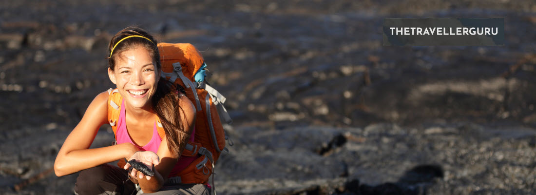
Hey there my outdoor adventurers and welcome to my post where we will check out my 10 best hiking trails in Scotland this year. Scotland’s vast and rugged landscapes offer some of the most breathtaking hiking experiences in the world. With trails that meander through remote glens, skirt the edges of dramatic cliff faces and ascend to the summits of ancient, weathered peaks, you’re spoiled for choice.

Whether you’re an experienced hiker seeking a challenging route or you’re simply looking to enjoy an afternoon stroll with picturesque views, Scotland’s diverse trails cater to all levels of outdoor enthusiasts.
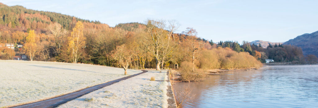
- The West Highland Way
- Ben Nevis
- The Great Glen Way
- Cairngorms National Park
- The Southern Upland Way
- The Isle of Skye
- The Rob Roy Way
- The East Highland Way
- The Arran Coastal Way
- The John Muir Way
Map Of The Best Hiking Trails In Scotland
Use the map below to find the locations of the best hiking trails Scotland has to offer in the post below:
Best Hiking Trails in Scotland
As above, Scotland is home to some of the best hiking trails to be found in the United Kingdom. Let’s check them out below:
1. The West Highland Way
The West Highland Way is Scotland’s first long-distance hiking trail and one of the most famous in the world, attracting walkers from across the globe. Stretching approximately 96 miles (154 km) from Milngavie on the outskirts of Glasgow to Fort William at the foot of Ben Nevis, Britain’s highest mountain, this trail offers an incredible variety of scenery.
For those undertaking the whole trail, hikers walk through the peaceful woodlands of Loch Lomond, the haunting beauty of Rannoch Moor, the rugged terrain of the Devil’s Staircase and finally to the majestic Highlands. Typically completed in 6 to 8 days, the West Highland Way is well-marked and accessible, with a range of accommodation options along the route as well making it suitable for both seasoned hikers and those new to long-distance walking.
Outline of the West Highland Way
- Milngavie to Drymen
- Distance: 12 miles (19 km)
- Access: Start in Milngavie town center, easily reached by train or bus from Glasgow.
- Trail Details: An easy start to the trail, passing through Mugdock Country Park and rolling farmland, offering a gentle introduction to the Scottish countryside.
- Drymen to Rowardennan
- Distance: 15 miles (24 km)
- Access: Begins in Drymen.
- Trail Details: This section includes the ascent of Conic Hill, providing stunning views over Loch Lomond, before descending to the tranquil shores of the loch at Rowardennan.
- Rowardennan to Inverarnan
- Distance: 14 miles (22.5 km)
- Access: Starts from Rowardennan, located on the eastern shore of Loch Lomond.
- Trail Details: A more challenging section, with undulating terrain along the loch’s edge, offering beautiful views and a chance to spot local wildlife.
- Inverarnan to Tyndrum
- Distance: 12 miles (19 km)
- Access: Begins in Inverarnan.
- Trail Details: The trail leads away from Loch Lomond, through Glen Falloch and into the open landscapes of Strath Fillan, with easier walking conditions.
- Tyndrum to Bridge of Orchy
- Distance: 7 miles (11 km)
- Access: Starts from Tyndrum.
- Trail Details: A relatively short and easy section, passing through moorland with expansive views of the surrounding mountains.
- Bridge of Orchy to Kingshouse
- Distance: 12 miles (19 km)
- Access: Begins at Bridge of Orchy.
- Trail Details: This spectacular section crosses Rannoch Moor, one of the most remote and beautiful areas in Scotland, offering breathtaking scenery.
- Kingshouse to Kinlochleven
- Distance: 9 miles (14.5 km)
- Access: Starts from Kingshouse.
- Trail Details: Includes the ascent of the Devil’s Staircase, the highest point on the trail, before descending into the village of Kinlochleven.
- Kinlochleven to Fort William
- Distance: 16 miles (26 km)
- Access: Begins in Kinlochleven.
- Trail Details: The final section of the trail climbs out of Kinlochleven and crosses the Lairig Mor pass before descending into Glen Nevis and finishing in Fort William, with stunning views of Ben Nevis.
The West Highland Way is a journey through the heart of Scotland’s wild landscapes offering hikers a memorable experience filled with natural beauty, history, and the warm hospitality of the Scottish Highlands.
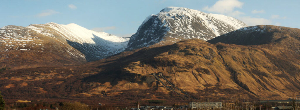
2. Ben Nevis
Ben Nevis, the highest mountain in the British Isles, stands at an imposing height of 1,345 meters (4,413 feet) near the town of Fort William in the Scottish Highlands. This majestic peak attracts hikers, climbers and outdoor enthusiasts from all over the world, offering various routes that cater to different levels of experience and adventure.
The most popular path to the summit is the Mountain Track (formerly known as the Tourist Path), which is well-trodden and accessible to those with a good level of fitness, despite its challenges. Or for the more experienced, the North Face offers a range of climbing and scrambling routes that navigate through some of Britain’s most spectacular and challenging mountain terrain. Hiking Ben
Outline of Hiking Trails on Ben Nevis
- The Mountain Track (Tourist Path)
- Location: Starts at the Glen Nevis Visitor Centre, just outside Fort William.
- Access: Easily accessible by car or public transport from Fort William. There’s a chargeable car park at the Visitor Centre.
- Trail Details: The Mountain Track is approximately 10.5 miles (17 km) round trip, with a total ascent of about 1,352 meters (4,436 feet). It’s the most straightforward route to the summit, featuring a well-maintained path with zigzags as it climbs the mountain’s western flank. The average time for completion is 7-9 hours. Despite being the easiest route, it still requires a good level of fitness, appropriate clothing, and preparation, as weather conditions can change rapidly.
- The Carn Mor Dearg Arete
- Location: Approaches Ben Nevis from the east, starting near the North Face car park.
- Access: The North Face car park is located off the road to Glen Nevis, providing a starting point for this route.
- Trail Details: This challenging route is approximately 11 miles (18 km) round trip and involves a total ascent of around 1,500 meters (4,921 feet). It’s suitable for experienced hikers and involves scrambling. The route includes the ascent of Carn Mor Dearg and then traverses the CMD Arete before the final climb to the summit of Ben Nevis. This path offers stunning views of the North Face and is considered one of the most rewarding ways to reach the summit, taking approximately 10-12 hours.
- The Ledge Route
- Location: Climbs the North Face of Ben Nevis, starting near the CIC Hut.
- Access: The starting point is the same as for the CMD Arete, near the North Face car park.
- Trail Details: The Ledge Route is a Grade 2 scramble, making it accessible to those with some scrambling experience but not requiring the technical skills of rock climbing. It’s a less frequented route, offering a sense of adventure and solitude. Climbers should be prepared for exposure and navigation challenges, especially in poor weather.
- Tower Ridge
- Location: Another route on the North Face of Ben Nevis.
- Access: Begins near the North Face car park, with a walk-in to the CIC Hut.
- Trail Details: Tower Ridge is a classic Grade 3S scramble, one of the most famous in Britain, offering an exhilarating and challenging route to the summit. It requires good scrambling skills, a head for heights, and, ideally, some climbing experience. The route is best attempted with climbing gear and, unless you’re experienced in such terrain, a guide.
Climbing Ben Nevis is a significant achievement due to the mountain’s height, the potential for severe weather conditions, and the physical challenge involved. Regardless of the route chosen, hikers and climbers should be well-prepared with appropriate gear, check weather forecasts and consider their experience and fitness levels as well.
3. The Great Glen Way
The Great Glen Way is a spectacular long-distance hiking trail in Scotland, stretching for 79 miles (127 km) from Fort William in the southwest to Inverness in the northeast. Following the Great Glen, a geological fault line that divides the Scottish Highlands into the Grampian Mountains to the southeast and the Northwest Highlands to the northwest, the trail offers hikers breathtaking views of some of Scotland’s most stunning landscapes including Loch Ness, Loch Lochy, and Loch Oich.
The route is well-marked and traverses through a variety of terrains from canal towpaths and forest tracks to high mountain paths, making it accessible to walkers of all abilities. The Great Glen Way can be completed in 5 to 7 days, depending on pace and offers a range of accommodation options, making it a versatile choice for both short and long-distance walkers.
Outline of The Great Glen Way
- Fort William to Gairlochy
- Distance: 10.5 miles (17 km)
- Access: The trail begins in Fort William, near the Old Fort, easily accessible by train, bus, or car.
- Trail Details: This initial section is relatively flat and easy, following the Caledonian Canal’s towpath with views of Ben Nevis, and leading to the small settlement of Gairlochy.
- Gairlochy to Laggan
- Distance: 12 miles (19 km)
- Access: Starts from Gairlochy.
- Trail Details: The path continues along the canal before passing through forested areas and alongside Loch Lochy, offering peaceful woodland walks and loch-side views.
- Laggan to Fort Augustus
- Distance: 10.5 miles (17 km)
- Access: Begins in Laggan, after crossing the Laggan Swing Bridge.
- Trail Details: This section includes a mix of forest tracks and canal paths, leading to Fort Augustus at the southern end of Loch Ness. The route offers scenic views and a chance to spot local wildlife.
- Fort Augustus to Invermoriston
- Distance: 8 miles (13 km)
- Access: Starts from Fort Augustus.
- Trail Details: Ascending from Fort Augustus, this more challenging section offers stunning views over Loch Ness. The path winds through forests and offers a mix of uphill and downhill walking.
- Invermoriston to Drumnadrochit
- Distance: 14 miles (22.5 km)
- Access: Begins in Invermoriston.
- Trail Details: Continuing along the side of Loch Ness, this section involves some steep climbs and descents through wooded areas, with spectacular views of the loch and surrounding countryside.
- Drumnadrochit to Inverness
- Distance: 18 miles (29 km)
- Access: Starts from Drumnadrochit.
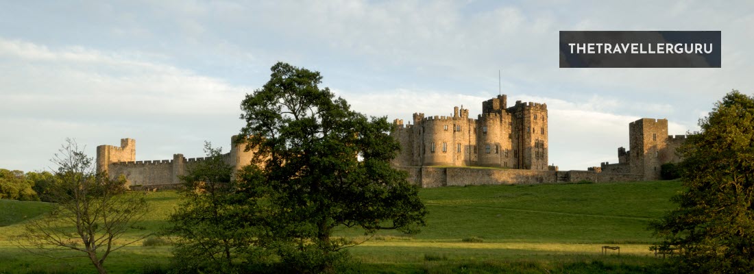
- Trail Details: The final stretch to Inverness is the longest section, passing through varied landscapes including open moorland and forest. The trail concludes at Inverness Castle, offering a rewarding end to the journey with panoramic views over the city and the Moray Firth.
Whether undertaken as a continuous journey or in sections, the trail provides a memorable adventure with opportunities to explore the natural and historical richness of some of Scotland’s most iconic and beautiful landscapes.
Book your hiking trip to Scotland here!
4. Cairngorms National Park
Cairngorms National Park, located in the heart of the Scottish Highlands, is Britain’s largest national park and a premier destination for outdoor enthusiasts. Renowned for its stunning landscapes, the park encompasses vast ancient forests, serene lochs and some of Scotland’s highest mountains, including several over 4,000 feet.
The Cairngorms also offer a diverse range of hiking trails that cater to all levels from leisurely woodland walks to challenging mountain treks. The area is rich in wildlife as well with opportunities to see golden eagles, red deer, and if lucky, the elusive Scottish wildcat. With its breathtaking scenery and diverse habitats, Cairngorms National Park is a haven for hikers looking to explore the natural beauty of the Scottish Highlands.
Outline of Hiking Trails in Cairngorms National Park
- Loch an Eilein
- Location: Near Aviemore
- Access: Easily accessible by car or bike from Aviemore, with a car park at the trailhead.
- Trail Details: A relatively easy, family-friendly loop of about 3 miles (5 km) that circles the picturesque Loch an Eilein, offering stunning views of the loch and its island castle ruins.
- Ben Macdui
- Location: The second highest mountain in the UK, located in the heart of the Cairngorms.
- Access: Start from the Cairngorm Ski Centre car park, or for a longer hike, begin from Linn of Dee.
- Trail Details: A challenging hike to the summit of Ben Macdui (4,295 feet/1,309 meters), approximately 7 miles (11 km) from the ski centre. The route offers spectacular views of the Cairngorms plateau and the chance to experience the high mountain environment.
- The Lairig Ghru
- Location: A high mountain pass running roughly north-south through the Cairngorms.
- Access: Popular starting points are Braemar in the south and Aviemore in the north.
- Trail Details: One of Scotland’s most famous mountain passes, this challenging route is approximately 19 miles (31 km) long, traversing through the heart of the Cairngorms with dramatic scenery.
- Rothiemurchus Forest Trails
- Location: Near Aviemore
- Access: Various entry points, with the Rothiemurchus Centre providing information and parking.
- Trail Details: A network of easy to moderate trails through one of Scotland’s most beautiful ancient Caledonian Pine forests, offering peaceful walks with opportunities to see wildlife.
- Cairn Gorm Mountain
- Location: One of the most prominent mountains in the Cairngorms, near Aviemore.
- Access: Start from the Cairngorm Ski Centre car park.
- Trail Details: A more strenuous hike to the summit of Cairn Gorm (4,084 feet/1,245 meters), approximately 4 miles (6.4 km) round trip, offering panoramic views of the surrounding highlands.
- Glenmore Forest Park
- Location: Near Aviemore
- Access: Accessible from Aviemore, with parking available at the Glenmore Visitor Centre.
- Trail Details: Offers a variety of trails, from easy walks around Loch Morlich to more challenging hikes up Meall a’ Bhuachaille, a Corbett peak.
- The Green Loch (An Lochan Uaine)
- Location: Near Glenmore
- Access: Start from the Glenmore Visitor Centre.
- Trail Details: An easy, family-friendly walk of about 2 miles (3.2 km) to a stunning green-colored loch nestled in the forest, with folklore tales adding to its charm.
Each trail in Cairngorms National Park offers a unique way to experience the natural beauty and majesty of the Scottish Highlands. Whether you’re seeking a gentle walk through ancient woodlands or a challenging hike to the summit of a towering peak, the Cairngorms provide a memorable outdoor adventure for every hiker.

5. The Southern Upland Way
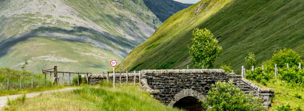
The Southern Upland Way is Scotland’s first and longest coast-to-coast long-distance hiking trail, spanning approximately 214 miles (344 km) from the Atlantic Ocean in the west to the North Sea in the east. This challenging and scenic route crosses the remote and beautiful Southern Uplands of Scotland, offering hikers a unique opportunity to experience the country’s less-visited landscapes.
The trail passes through a diverse range of environments including rugged hills, rolling moorland, serene forests and picturesque valleys, providing stunning views and a sense of solitude. The Southern Upland Way is designed for experienced walkers, given its length and the demanding nature of some of its sections and can be completed in sections or as a continuous journey, typically taking 12 to 16 days to complete.
Outline of The Southern Upland Way
- Portpatrick to Castle Kennedy
- Distance: 13.5 miles (21.7 km)
- Access: Begins in the coastal village of Portpatrick.
- Trail Details: This initial section offers coastal views, cliff-top walking and a gentle introduction to the Southern Uplands, ending in the historic grounds of Castle Kennedy.
- Castle Kennedy to New Luce
- Distance: 8.5 miles (13.7 km)
- Access: Starts from Castle Kennedy.
- Trail Details: A relatively easy walk through farmland and alongside the tranquil waters of the Black Loch.
- New Luce to Bargrennan
- Distance: 17.5 miles (28.2 km)
- Access: Begins in New Luce.
- Trail Details: This longer section traverses remote upland areas, offering expansive views and a true sense of wilderness.
- Bargrennan to St John’s Town of Dalry
- Distance: 25 miles (40.2 km)
- Access: Starts from Bargrennan.
- Trail Details: One of the more challenging sections, crossing several hills and moorlands, with rewarding views and the chance to visit the Bruce’s Stone.
- St John’s Town of Dalry to Sanquhar
- Distance: 26.5 miles (42.6 km)
- Access: Begins in St John’s Town of Dalry.
- Trail Details: This section includes walking through the scenic Glenkens and over the watershed into Nithsdale, with historic sites along the way.
- Sanquhar to Wanlockhead
- Distance: 7.5 miles (12.1 km)
- Access: Starts from Sanquhar.
- Trail Details: A shorter but steep section leading to Wanlockhead, Britain’s highest village, known for its lead mining history.
- Wanlockhead to Beattock
- Distance: 20 miles (32.2 km)
- Access: Begins in Wanlockhead.
- Trail Details: Crossing the Lowther Hills, this section offers challenging hill walking before descending into the Moffat Valley.
- Beattock to St Mary’s Loch
- Distance: 21 miles (33.8 km)
- Access: Starts from Beattock.
- Trail Details: This part of the trail takes hikers through the Moffat Hills and by the picturesque St Mary’s Loch.
- St Mary’s Loch to Traquair
- Distance: 12.5 miles (20.1 km)
- Access: Begins near St Mary’s Loch.
- Trail Details: A relatively easy section through the Yarrow Valley, offering pleasant walking and historical interest.
- Traquair to Lauder
- Distance: 15 miles (24.1 km)
- Access: Starts from Traquair.
- Trail Details: This section includes forest trails and open moorland, with views of the surrounding hills.
- Lauder to Longformacus
- Distance: 15.5 miles (24.9 km)
- Access: Begins in Lauder.
- Trail Details: The trail crosses the Lammermuir Hills, offering remote walking with extensive views.
- Longformacus to Cockburnspath
- Distance: 18 miles (29 km)
- Access: Starts from Longformacus.
- Trail Details: The final section descends from the Lammermuir Hills to the eastern coast, finishing at the North Sea in Cockburnspath.
The Southern Upland Way is a rewarding challenge for those looking to explore the varied and often remote landscapes of southern Scotland. It requires however careful planning, especially for accommodation and supplies as some sections pass through areas with limited services.
6. The Isle of Skye
The Isle of Skye, located off the west coast of Scotland, is renowned for its dramatic landscapes from rugged coastlines and towering cliffs to rolling hills and serene lochs. This mystical island, rich in history and folklore, offers a diverse array of hiking trails that cater to all levels of experience.
Moreover, Skye’s trails provide the opportunity to explore its natural wonders including the famous Cuillin range, the Quiraing, and the Old Man of Storr, amongst others. Each hike on the island presents a unique adventure, whether you’re seeking a leisurely walk with breathtaking views or a challenging trek up rugged peaks.
Outline of Hiking Trails on the Isle of Skye
- The Old Man of Storr
- Location: North of Portree
- Access: Easily accessible by car, with a parking area on the A855.
- Trail Details: A moderate hike of about 3.8 miles (6.1 km) round trip, leading to iconic rock formations with stunning views over the Sound of Raasay.
- The Quiraing
- Location: Northern Skye
- Access: Start from the car park near Staffin or the smaller one closer to the Quiraing.
- Trail Details: A moderate loop of approximately 4.2 miles (6.8 km), offering some of Skye’s most dramatic landscapes including high cliffs, hidden plateaus and unique rock features.
- The Fairy Pools
- Location: Near Glenbrittle
- Access: A car park is located on the road to Glenbrittle, from where the trail starts.
- Trail Details: An easy to moderate walk of about 2.4 miles (3.9 km) round trip, leading to beautifully clear pools and waterfalls, ideal for those looking for a less strenuous hike.
- The Cuillin Ridge
- Location: Central Skye
- Access: Various access points, including Glenbrittle and Sligachan.
- Trail Details: A challenging and technical route for experienced climbers and mountaineers, offering some of the UK’s most dramatic and challenging terrain. The full traverse is approximately 7 miles (11 km) but requires climbing skills.
- Neist Point
- Location: Western tip of Skye
- Access: Start from the car park at the end of the minor road from Glendale.
- Trail Details: An easy to moderate walk of about 2 miles (3.2 km) round trip, leading to a lighthouse with spectacular views of the cliffs and the possibility of spotting whales and dolphins.
- Rubha Hunish
- Location: The northernmost tip of Skye
- Access: Start from the small parking area off the road between Duntulm and Kilmuir.
- Trail Details: An easy to moderate walk of about 4.5 miles (7.2 km), offering stunning coastal scenery and the chance to see a variety of seabirds.
- Blà Bheinn (Blaven)
- Location: Near Broadford
- Access: Start from the car park at the end of the minor road leading to Loch Slapin.
- Trail Details: A challenging hike of about 5 miles (8 km) round trip to one of the most accessible summits in the Cuillin range, providing exceptional views.
- The Trotternish Ridge
- Location: Northern Skye
- Access: Various starting points, including The Quiraing and The Storr.
- Trail Details: A challenging and long-distance hike of approximately 20 miles (32 km), traversing the length of the Trotternish Ridge with spectacular views and varied terrain.
Each trail on the Isle of Skye offers a unique way to experience the island’s natural beauty, from its towering sea cliffs and mystical rock formations to serene lochs and rugged mountains. Whether you’re an experienced hiker looking for a challenge or someone seeking a peaceful walk amidst stunning scenery, Skye’s trails provide unforgettable outdoor adventures.

7. The Rob Roy Way
Named after the legendary Scottish outlaw Rob Roy MacGregor, the Rob Roy Way is a captivating long-distance walking route in Scotland. Stretching approximately 79 miles (127 km) from Drymen to Pitlochry, the trail winds through the scenic heartlands of the Scottish Highlands, offering hikers a journey through areas rich in history, culture and natural beauty.
The route traverses the southern part of the Highlands, passing through Loch Lomond & The Trossachs National Park through ancient woodlands and over rolling hills. The trail is well-marked and suitable for walkers of moderate fitness levels with various sections that can be completed as day hikes or combined into a multi-day adventure.
Outline of The Rob Roy Way
- Drymen to Aberfoyle
- Distance: 10 miles (16 km)
- Access: Begins in Drymen, easily accessible by bus from Glasgow.
- Trail Details: This initial section takes hikers through the Queen Elizabeth Forest Park, offering a gentle introduction with forested paths and views of the surrounding countryside.
- Aberfoyle to Callander
- Distance: 10 miles (16 km)
- Access: Starts from Aberfoyle.
- Trail Details: The trail leads through more of the Queen Elizabeth Forest Park, passing by waterfalls and offering views of Ben Ledi before descending into the bustling town of Callander.
- Callander to Strathyre
- Distance: 9 miles (14.5 km)
- Access: Begins in Callander.
- Trail Details: This section follows the old railway line along the banks of the River Teith and through the Pass of Leny, entering the scenic Strathyre along the shores of Loch Lubnaig.
- Strathyre to Killin
- Distance: 12 miles (19 km)
- Access: Starts from Strathyre.
- Trail Details: The route continues through the Balquhidder Valley, past Rob Roy’s grave, and offers stunning views of the surrounding mountains before reaching the village of Killin, famous for the Falls of Dochart.
- Killin to Ardtalnaig
- Distance: 12 miles (19 km)
- Access: Begins in Killin.
- Trail Details: This leg of the journey takes hikers along the south side of Loch Tay, through woodland and farmland, with panoramic views across the loch to the Ben Lawers mountain range.
- Ardtalnaig to Aberfeldy
- Distance: 14 miles (22.5 km)
- Access: Starts from Ardtalnaig.
- Trail Details: Continuing along Loch Tay, the trail then heads into the hills towards Aberfeldy, passing through remote areas with spectacular Highland scenery.
- Aberfeldy to Pitlochry
- Distance: 11 miles (17.7 km)
- Access: Begins in Aberfeldy.
- Trail Details: The final section crosses the River Tay and follows the river valley through woodland and past historic sites, including the famous Birks of Aberfeldy, before concluding in the Victorian town of Pitlochry.
The Rob Roy Way offers hikers not only a physical challenge but also a journey through the history and natural beauty of central Scotland. It’s advisable to plan accommodations in advance, especially during the peak summer months, and to prepare for variable weather conditions. Whether undertaken in sections or as a continuous trek, the Rob Roy Way provides a memorable experience for anyone interested in Scotland’s rich cultural heritage and stunning landscapes.
Book your hiking trip to Scotland here!
8. The East Highland Way
The East Highland Way is a fascinating long-distance walking route in Scotland, stretching approximately 82 miles (132 km) from Fort William, at the foot of Ben Nevis, to Aviemore, in the heart of the Cairngorms National Park. Established in 2007, this trail offers hikers an opportunity to explore the lesser-known landscapes of the Scottish Highlands, including tranquil forests, serene lochs and remote moorlands.
The route connects the West Highland Way with the Speyside Way, creating a link between the west and east coasts of Scotland. And unlike the more famous West Highland Way, the East Highland Way passes through quieter, more secluded areas, providing a sense of solitude and immersion in nature. The trail is suitable for walkers with some long-distance hiking experience and offers a variety of accommodations along the route, from camping to guest houses as well.
Outline of The East Highland Way
- Fort William to Spean Bridge
- Distance: 10 miles (16 km)
- Access: The trail begins in Fort William, which is easily accessible by train, bus, or car.
- Trail Details: This initial section takes hikers along the banks of the River Lochy and through Leanachan Forest, offering views of Ben Nevis and the Nevis Range.
- Spean Bridge to Corrour
- Distance: 15 miles (24 km)
- Access: Starts from Spean Bridge, accessible by road and rail.
- Trail Details: A remote and challenging section that crosses the wild and rugged landscapes of the Corrour Estate, with the option to stay overnight at the remote Corrour Station, the UK’s highest railway station.
- Corrour to Loch Ossian
- Distance: Approximately 3 miles (5 km)
- Access: Begins at Corrour Station.
- Trail Details: A shorter, easier section along the shore of Loch Ossian, offering peaceful loch-side walking and the chance to stay at the eco-friendly Loch Ossian Youth Hostel.
- Loch Ossian to Dalwhinnie
- Distance: 20 miles (32 km)
- Access: Starts from Loch Ossian.
- Trail Details: This section traverses the remote wilderness between Loch Ossian and Dalwhinnie, passing through the Ben Alder estate with its stunning landscapes.
- Dalwhinnie to Newtonmore
- Distance: 9 miles (14.5 km)
- Access: Begins in Dalwhinnie, known for its whisky distillery.
- Trail Details: A relatively easy walk that follows the Spey River valley, offering picturesque views and a gentle introduction to the Cairngorms National Park.
- Newtonmore to Kingussie
- Distance: 3 miles (5 km)
- Access: Starts from Newtonmore.
- Trail Details: A short and pleasant walk between these two Highland villages, both of which offer a range of accommodations and amenities.
- Kingussie to Kincraig
- Distance: 12 miles (19 km)
- Access: Begins in Kingussie.
- Trail Details: This section takes hikers through the Insh Marshes National Nature Reserve and past the picturesque Ruthven Barracks, offering opportunities to spot wildlife and enjoy the natural beauty of the area.
- Kincraig to Aviemore
- Distance: 10 miles (16 km)
- Access: Starts from Kincraig.
- Trail Details: The final section of the trail leads to Aviemore, a popular outdoor recreation center in the Cairngorms. This part of the route offers views of Loch Insh and passes through beautiful pine forests.
The East Highland Way provides a unique and immersive experience of the Scottish Highlands, away from the more crowded tourist trails. It’s a journey through some of Scotland’s most serene and untouched landscapes, offering a true adventure for those looking to explore the natural beauty and tranquility of this region.
9. The Arran Coastal Way
The Arran Coastal Way is a captivating long-distance walking route that circumnavigates the Isle of Arran, often referred to as “Scotland in Miniature” due to its diverse landscapes. This 65-mile (105 km) trail offers hikers the opportunity to explore Arran’s stunning coastline which features sandy beaches, rugged cliffs, caves and a series of picturesque villages. The route also passes by ancient castles, prehistoric standing stones and offers chances to spot a wide array of wildlife including seals, otters and numerous bird species as well.
The Arran Coastal Way is suitable for walkers of moderate fitness levels, with options to tackle the trail in sections or as a continuous journey. The path provides a mix of easy beach walks, forest trails and more challenging rocky sections, particularly around the island’s northern part.
Outline of The Arran Coastal Way
- Brodick to Sannox
- Distance: 8.5 miles (13.7 km)
- Access: Begins in Brodick, the main arrival point on Arran for ferries from the mainland.
- Trail Details: This section offers a gentle start along the coast, with views of Brodick Castle and Goat Fell, Arran’s highest peak. The path includes beach walking and some road sections.
- Sannox to Lochranza
- Distance: 9 miles (14.5 km)
- Access: Starts from Sannox.
- Trail Details: A more challenging section, featuring rugged terrain and spectacular coastal scenery. Highlights include the Fallen Rocks and the scenic approach to Lochranza with its castle ruins.
- Lochranza to Imachar
- Distance: 13 miles (21 km)
- Access: Begins in Lochranza.
- Trail Details: This part of the trail takes walkers along the remote and wild northwest coast of Arran, offering solitude and stunning landscapes. The terrain can be rough and boggy in places.
- Imachar to Blackwaterfoot
- Distance: 6 miles (9.7 km)
- Access: Starts from Imachar.
- Trail Details: A relatively easy section, with paths through farmland and along sandy beaches, leading to the village of Blackwaterfoot.
- Blackwaterfoot to Lagg
- Distance: 8 miles (12.9 km)
- Access: Begins in Blackwaterfoot.
- Trail Details: This section features the impressive Drumadoon Cliffs and the prehistoric King’s Cave. The path then continues along the coast to Lagg.
- Lagg to Whiting Bay
- Distance: 11 miles (17.7 km)
- Access: Starts from Lagg.
- Trail Details: A varied section that includes beach walking, forest trails and some road walking, with beautiful views across to the Ayrshire coast.
- Whiting Bay to Brodick
- Distance: 10 miles (16 km)
- Access: Begins in Whiting Bay.
- Trail Details: The final section returns to Brodick via coastal paths and forest trails, passing by the scenic Glenashdale Falls and the Giants’ Graves Neolithic burial site.
The Arran Coastal Way is a journey that offers an intimate experience of the Isle of Arran’s natural beauty and cultural heritage. The route is well-marked, but some sections require careful navigation, especially in adverse weather conditions and accommodations ranging from campsites to comfortable B&Bs are available along the route.
Check out these: 3 Best Boots for Hiking
10. The John Muir Way
The John Muir Way is a long-distance walking and cycling route in Scotland, spanning 134 miles (215 km) from Helensburgh on the west coast to Dunbar on the east coast, the birthplace of the renowned naturalist and conservationist John Muir. Established to commemorate Muir’s legacy and his contribution to the creation of national parks and conservation efforts around the world, the trail offers a diverse journey through Scotland’s landscapes, heritage and history.
The trail passes through national parks, along scenic coastlines, beside tranquil lochs, through rolling farmland and into the heart of Scotland’s capital, Edinburgh. The route is designed to be accessible, offering walkers and cyclists a chance to explore the varied landscapes of southern Scotland at a leisurely pace or as a challenging expedition.
Outline of The John Muir Way
- Helensburgh to Balloch
- Distance: 9 miles (14.5 km)
- Access: Begins in Helensburgh, accessible by train from Glasgow.
- Trail Details: This initial section offers views over the Clyde Estuary and passes through the scenic countryside before reaching Loch Lomond at Balloch.
- Balloch to Strathblane
- Distance: 18 miles (29 km)
- Access: Starts from Balloch.
- Trail Details: The trail moves away from Loch Lomond, winding through farmland and woodland, with views of the Campsie Fells as it approaches Strathblane.
- Strathblane to Falkirk
- Distance: 20 miles (32 km)
- Access: Begins in Strathblane.
- Trail Details: This section includes walking along the Forth & Clyde Canal and past the iconic Kelpies sculptures, leading to the historic town of Falkirk.
- Falkirk to Linlithgow
- Distance: 9 miles (14.5 km)
- Access: Starts from Falkirk.
- Trail Details: A relatively easy walk that continues along the canal, passing the impressive Falkirk Wheel, before reaching the historic town of Linlithgow.
- Linlithgow to South Queensferry
- Distance: 12 miles (19 km)
- Access: Begins in Linlithgow.
- Trail Details: The trail heads towards the coast, offering views of the Firth of Forth and the iconic Forth Bridges as it approaches South Queensferry.
- South Queensferry to Edinburgh
- Distance: 16 miles (26 km)
- Access: Starts from South Queensferry.
- Trail Details: This urban section takes walkers through the outskirts of Edinburgh, along the waterfront and into the city center, passing by historic sites and attractions.
- Edinburgh to Prestonpans
- Distance: 10 miles (16 km)
- Access: Begins in Edinburgh.
- Trail Details: Exiting the capital, the route follows the coast eastward, offering beach walks and views across the Firth of Forth.
- Prestonpans to North Berwick
- Distance: 16 miles (26 km)
- Access: Starts from Prestonpans.
- Trail Details: Continuing along the coast, this section passes through Aberlady Bay Nature Reserve and the seaside town of Gullane, before reaching North Berwick.
- North Berwick to Dunbar
- Distance: 14 miles (22.5 km)
- Access: Begins in North Berwick.
- Trail Details: The final leg of the journey takes walkers along coastal paths, past the dramatic cliffs of Tantallon Castle, and into Dunbar, John Muir’s birthplace.
The John Muir Way offers a unique opportunity to explore the natural beauty, cultural heritage and historical landmarks of southern Scotland. Whether undertaken in sections or as a continuous journey, the route provides a memorable experience for walkers and cyclists alike.
What to Consider Before Hiking in Scotland
Before setting off to traverse Scotland’s beautiful landscapes, it’s important to be well-prepared. By considering when to go, the trail difficulty, safety, and essential gear, your hiking experience will be both enjoyable and secure.
Best Time of Year
Spring and Summer: Enjoy milder weather and longer daylight hours, ideal for hiking. May to September offers the best conditions for trails like the West Highland Way.
Difficulty Levels
- Beginner: Opt for easy, well-marked trails.
- Experienced: Seek out challenging routes like Liathach in Glen Torridon for a more strenuous adventure.
Safety Tips
- Check weather: Scottish weather can be unpredictable; always check the forecast.
- Inform someone: Let others know your route and expected return time.
Essential Gear
- Footwear: Durable, waterproof hiking boots are a must.
- Clothing: Layered, moisture-wicking fabrics adapt to changing conditions.
- Navigation: A map and compass or GPS can prevent getting lost on unmarked Highland trails.
FAQs
What are the best times of year to hike the trails in Scotland?
The best times to hike in Scotland are during the spring (May to June) and autumn (September to October) months. During these periods, you’re likely to experience milder weather, fewer midges (particularly in the Highlands) and the natural scenery is at its most vibrant, with spring flowers or autumnal colors. However, weather in Scotland can be unpredictable, so it’s essential to be prepared for rain or shine. Summer (July to August) offers longer daylight hours, making it a popular time for hiking, but this is also when midges are most prevalent, especially in the west and north of Scotland.
Conclusion
And there they are, my recommended best hiking trails in the UK. As usual, let me know of your experiences here or if there are any others that I should be adding.
Also, please do not hesitate to comment below if you have any questions, concerns, or corrections, or would like me to check anything else out for you.
Until next time.
Have fun
Paul