Hey there travel enthusiasts and welcome to my post where we will check out my 9 best hiking trails in the united kingdom this year. While the UK may not boast the world’s tallest peaks, they compensate with some of the most enchanting scenery in the world from the untamed beauty of the lakes district to the renowned splendor of the Scottish Highlands.

On top of that, hiking not only offers an invigorating workout but also an unparalleled opportunity to connect with nature. So for those of you looking to don the hiking boots and get out into the UK wilderness, let’s check out 10 good hiking trails in the region below.
- Coast to Coast Walk
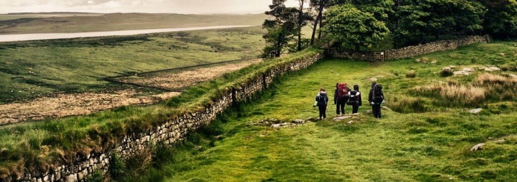
- Hadrian’s Wall
- The Quiraing, Isle of Skye
- Lizard Peninsula, Cornwall
- Helvellyn, Lake District
- Yorkshire Three Peaks Circular
- Kinder Scout and Kinder Downfall Circular
- Castleton, Mam Tor and the Great Ridge Circular
- Hawes End, Cat Bells and Derwent Circular
Map Of The Best Hiking Trails UK Has to Offer
Here is a map with locations of the best hiking trails in Great Britain as per below.
Best Hiking Trails in the United Kingdom
Ok, for the avid hikers amongst us, here are some good options to choose from in the United Kingdom.
1. Coast to Coast Walk
The Coast to Coast Walk is a 192-mile long-distance walking trail that stretches across the breadth of England from St Bees in Cumbria to Robin Hood’s Bay in North Yorkshire. It’s not an individual path but rather a network of interconnected footpaths, bridleways, minor roads and rights of way curated by Alfred Wainwright.
Despite not holding national trail status, this hike is incredibly popular and is perhaps the most favored long-distance walk in both Great Britain and the world. It offers diverse and captivating scenery providing walkers with an opportunity to experience the gentle beauty of the Lake District mountains, the splendor of the Yorkshire Dales and the undulating hills of the North York Moors while immersing themselves in England’s ancient history.
A cherished tradition among those who complete the entire trail is to start by wetting their boots in the sea at St Bees and collecting a pebble. This pebble is then carried the entire length of the hike and placed on the beach at Robin Hood’s Bay, where participants wet their boots again, but this time in the waters of a different sea.
General information:
| Distance | 192 miles or 309 kilometers |
| Average time to complete | 16 days |
| Highest point | Kidsty Pike (780 meters) |
| Type of hike | Point-to-point |
2. Hadrian’s Wall
Hiking the Hadrian’s Wall Path offers a unique and historical adventure, tracing the footsteps of Emperor Hadrian’s monumental creation. Hadrian’s Wall, constructed in 122 AD, was built to protect the northern border of the Roman Empire from northern barbarian threats.
This remarkable barrier, spanning 73 miles, stretched from the Solway Firth to Wallsend on the River Tyne. It not only stands as the largest Roman archaeological feature in Britain but is also hailed as the world’s best-preserved Roman frontier. In 1987, Hadrian’s Wall earned the prestigious title of a UNESCO World Heritage Site.
In 2003, it was designated as England’s 15th National Trail and it stands as one of the most popular among the sixteen National Trails in England. The reasons for its popularity are numerous and every step of the way, hikers are immersed in history, encountering Roman settlements and forts.
Additionally, the trail offers the delightful amenities of cozy pubs, vibrant market towns and awe-inspiring scenic vistas along the way as well.
General information:
| Distance | 84 miles or 135 kilometers |
| Average time to complete | 6 to 10 walking days |
| Highest point | Winshield Crags (345 meters) |
| Type of hike | Point-to-point |
Check out these: 10 Best Golf Courses in the United Kingdom
3. The Quiraing, Isle of Skye
The Quiraing circuit, situated on the Isle of Skye in Scotland, offers a stunning hiking experience along a portion of the Trotternish Ridge. The Isle of Skye is nestled in the northwest corner of Scotland and is easily accessible by car via a bridge that connects it to the mainland.
The Quiraing is a highly popular hike on the Isle of Skye and ranks among the top hikes on the island and should be on your Isle of Skye to-do list if you’re able to tackle it. Even if you can’t embark on the full hike, the views near the Quiraing carpark alone are worth the drive.
Found in the northern Trotternish Peninsula, the Quiraing is part of a striking mountain ridge formed by a massive landslip. This geological wonder has shaped the landscape into a captivating terrain with unique rock formations that make for an engaging hike.
The vistas along this trail are nothing short of breathtaking. From the very start, you’ll be treated to sights of towering cliffs, intriguing rock formations, numerous inland lochs and the Sound of Raasay, the sparkling ocean. The absence of trees ensures that the stunning scenery remains in full view throughout the hike.
As an added touch of Scottish authenticity, sheep graze on the slopes along the path as well lending a distinctive Scottish ambiance—just be mindful of where you step, as sheep are known to leave their mark.
General information:
| Distance | 4.2 miles or 6.7 kilometers |
| Average time to complete | 2 to 3 hours |
| Highest point | 401 meters |
| Type of hike | Circular |
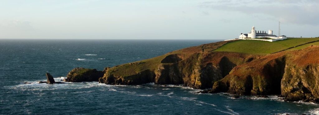
4. Lizard Peninsula, Cornwall
Exploring the Lizard Peninsula, you’ll discover a variety of walks catering to different preferences and abilities where options range from leisurely strolls along scenic beaches to more challenging treks across rugged landscapes. The trail meanders along sandy beaches and stony cliff-top paths providing a mix of terrains and whilst there are some slopes and steps to conquer, hikers are rewarded with a height gain of over 700 feet (220 meters).
One of the most beloved hikes in the area is the Kynance Cove to Lizard Point walk, which unveils some of the most breathtaking scenery the peninsula has to offer. Along this route, hikers can marvel at the turquoise waters of Kynance Cove, search for rare wildflowers and soak in panoramic coastal vistas, all culminating at the southernmost point of the UK.
For those intrigued by coastal history, the Gunwalloe Coves circular walk is also a great choice. It leads you to the remains of treasure-laden ships and the concealed underground tunnels once used by smugglers. Meanwhile, the lively Helford River provides a refreshing change of scenery from the rugged coastline, offering yet another delightful hiking option in this picturesque corner of the UK.
General information:
| Distance | 4.0 miles or 6.4 kilometers |
| Average time to complete | 2 to 3 hours |
| Highest point | 220 meters |
| Type of hike | Circular |
5. Helvellyn, Lake District
Helvellyn, the third-highest peak in both England and the Lake District, offers a more accessible hiking experience compared to the loftier Scafell Pike and Scafell. The landscape here boasts three impressive glacial coves and two distinctive ridges on the eastern side, known as Striding Edge and Swirral Edge.
Helvellyn’s popularity with hikers and explorers dates back to the late 18th century, making it a cherished destination for those seeking outdoor adventure.
The Helvellyn hike via Striding Edge and Swirral Edge forms a circular route spanning 8 miles (13 kilometers) in length. The duration of your journey can vary depending on your pace, the time spent navigating Striding Edge and Swirral Edge, and the moments taken to soak in the breathtaking scenery. Typically, this route can be completed in about 5 to 7 hours.
While Helvellyn can be tackled year-round, it’s advisable to plan your hike between late spring and early autumn. Winter conditions can bring heavy rain, strong winds, overcast skies and snow, making ridge hikes, especially along exposed routes, potentially hazardous. Low visibility, precipitation, and wind can increase the challenges of navigating this magnificent peak, so choosing the right season for your adventure is key.
General information:
| Distance | 8.0 miles or 13 kilometers |
| Average time to complete | 5 to 7 hours |
| Highest point | 950 meters |
| Type of hike | Out-and-back |
Book your trip to the United Kingdom here!
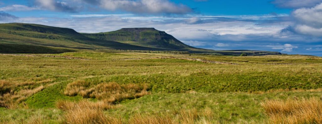
6. Yorkshire Three Peaks Circular
The Yorkshire Three Peaks, consisting of Pen-y-Ghent, Ingleborough and Whernside form a famous trio of peaks in Yorkshire. Hikers often embark on a circular route that includes all three mountains in a single day’s journey. This challenging route spans 24 miles (38.6 kilometers) and involves a substantial 5000 feet (1600 meters) of uphill climbing.
For those seeking an extra challenge, there’s the organized Three Peaks Challenge, where participants strive to conquer the entire route within a tight 12-hour window. Alternatively, you can opt to complete the challenge at your own pace over a day or two. Along the way, you’ll find several campsites and inns, providing opportunities for rest and refreshment as you conquer this iconic Yorkshire hiking experience.
General information:
| Distance | 24 miles or 38.6 kilometers |
| Average time to complete | 9 to 12 hours |
| Highest point | Whernside (736 meters) |
| Type of hike | Circular |
Check out these: Best UK Mountain Biking Trails
7. Kinder Scout and Kinder Downfall Circular
One of the finest hikes in the Peak District is the Kinder Scout and Kinder Downfall Circular. Kinder Scout, the tallest peak in the area, stands at an elevation of 636 meters above sea level and boasts a unique, almost table-like plateau at its summit that offers magnificent views of the surrounding Peak District.
Kinder Scout resides in the Dark Peak region of the Derbyshire Peak District, conveniently situated between the major cities of Manchester and Sheffield. It’s easily accessible from both locations and most walks to Kinder Scout commence from the charming villages of Edale and Hayfield. As you explore the Kinder plateau during your hike, you’ll encounter Kinder Downfall, the highest waterfall in the Peak District, cascading down from a height of 30 meters.
General information:
| Distance | 8.5 miles or 14 kilometers |
| Average time to complete | 4.5 hours |
| Highest point | 636 meters |
| Type of hike | Circular |
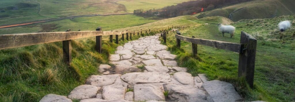
8. Castleton, Mam Tor, and the Great Ridge Circular
Next is the Castleton, Mam Tor and the Great Ridge Circular, a 12.9-kilometer loop trail nestled near Castleton, Derbyshire. This moderately challenging route typically takes about 4 hours and 34 minutes to complete and is a popular area for camping, hiking and running, so expect to encounter fellow outdoor enthusiasts along the way.
The best times to explore this trail are from March through November, allowing you to fully enjoy the outdoors. Dogs are also welcome on this trail but must be kept on a leash.
If your goal is to ascend Mam Tor and return, you’ll essentially follow a single well-maintained stone path. While it can be steep, it’s not slippery when dry, and the journey takes around 10-15 minutes each way.
For those aiming to complete the longer circuit walk, you’ll encounter more elevation changes, but the climbs are interspersed with relatively flat sections. The terrain is generally favorable, although the path along Cave Dale (depending on your chosen direction) consists of loose stones and can be a bit slippery, even in dry conditions.
It’s important to note however that most of the circuit is not signposted. The initial 4 kilometers leading up to Lose Hill are easy to follow, but there are some less obvious turns beyond that, particularly when crossing farmland between Lose Hill and Castleton and navigating the section between Cave Dale and Mam Tor. So, a good map or GPS navigation can be a valuable companion here.
General information:
| Distance | 8.4 miles or 13.6 kilometers |
| Average time to complete | 3 to 4 hours |
| Highest point | 420 meters |
| Type of hike | Circular |
Check out these: Best National Parks in the United Kingdom
9. Hawes End, Cat Bells, and Derwent Circular
The Hawes End, Cat Bells, and Derwent Circular hike in the Lake District form an invigorating outdoor adventure that appeals to a diverse range of walkers from beginners to seasoned explorers, and even families with adventurous youngsters.
This trail leads you southward and swiftly ascends challenging terrain, ultimately reaching the summit of Cat Bells.
From this lofty vantage point, prepare to be captivated by the panoramic vistas that stretch across the picturesque Derwent Water. As you descend the hillside to the southeast, the scenery remains nothing short of breathtaking. Then, your path meanders northward, skirting the lakeshore with more stunning views that epitomize the serene beauty of the area.
Eventually, your journey brings you back to the trailhead where your hike began, completing this memorable circular route through the captivating landscapes of the Lake District.
General information:
| Distance | 3.7 miles or 6 kilometers |
| Average time to complete | 2 to 3 hours |
| Highest point | 451 meters |
| Type of hike | Circular |
Conclusion
And there they are, my recommended best hiking trails in the UK. As usual, let me know of your experiences here or if there are any others that I should be adding.
Also, please do not hesitate to comment below if you have any questions, concerns, or corrections, or would like me to check anything else out for you.
Until next time.
Have fun
Paul